- Customer
- Sector
- Tags

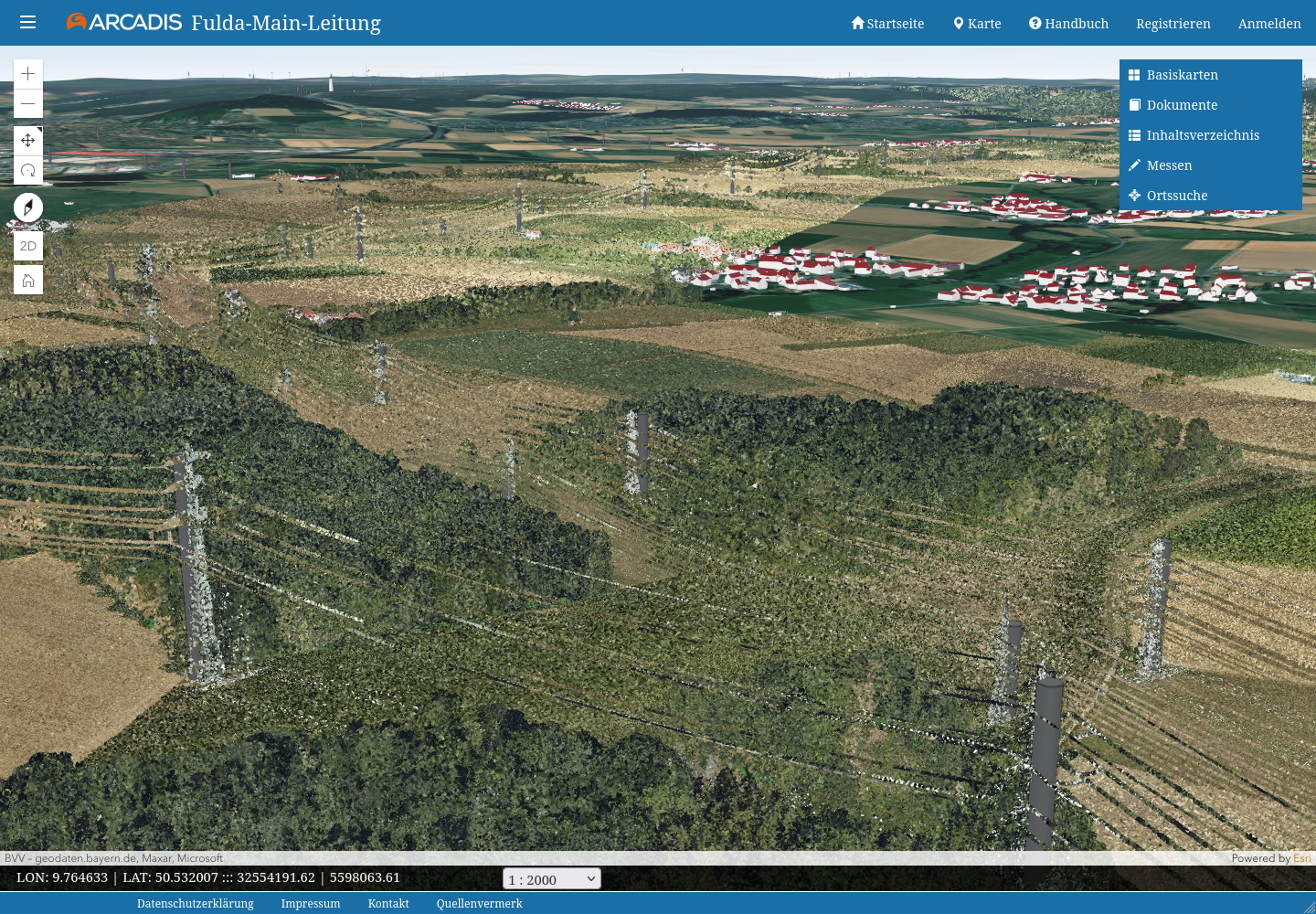
Expedite 3D
Project contents
Customer voice
We are working successfully with Pikobytes GmbH on the development of our WebGIS solution Expedite 3D. The agile implementation of the tasks and the concrete development results are very satisfactory. Expedite 3D as a high-quality product for the visualization and communication of geodata has enabled us to successfully open up new market sectors and subject areas. We can recommend Pikobytes GmbH without reservation.

Values our cooperation:
Frank Dünkel
Digital Solutions Lead, Arcadis Germany GmbH
Technology
ReactJS
ArcGIS Enterprise
ArcGIS Maps SDK for JavaScript
.NET Core
MS SQL Server
Azure

