In addition to our broad technological portfolio and in-depth methodological knowledge, we bring broad domain knowledge in the areas of infrastructure, environment and geoinformation to our projects. For highly specialized tasks and applications, we have a network of partner companies and research players that we can call on selectively for specific issues or involve in an advisory capacity.
GIS & Spatial analytics


We support you!
Data research
Research and evaluation of relevant data records for processing challenges in your organization or companyData integration & harmonization
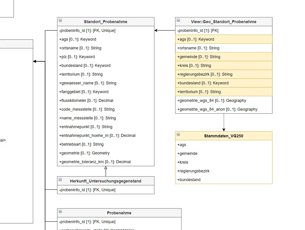
Merging and harmonization (semantic / syntactic) of various datasets in a consolidated datapool.Data Clearing
We help you clean up old data and support you with data migration.Analysis
Whether GIS, statistics or artificial intelligence, we are happy to help you. We extract information from large data lakes, develop algorithms and models of the future and help you tackle your organizational challenges.Automation
We develop and automate data pipelines, which constantly generate new insights from your data chaos.Visualization
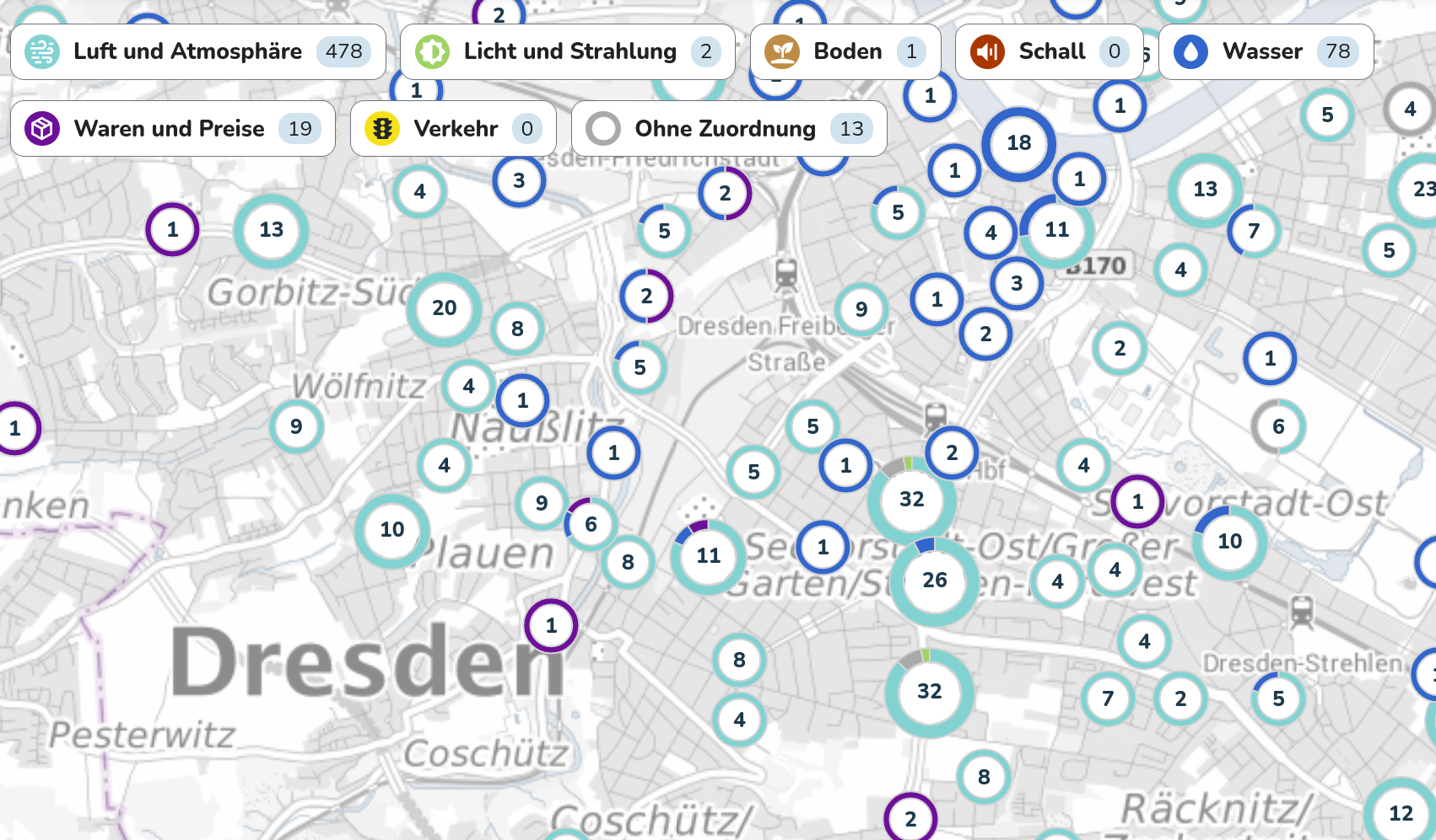
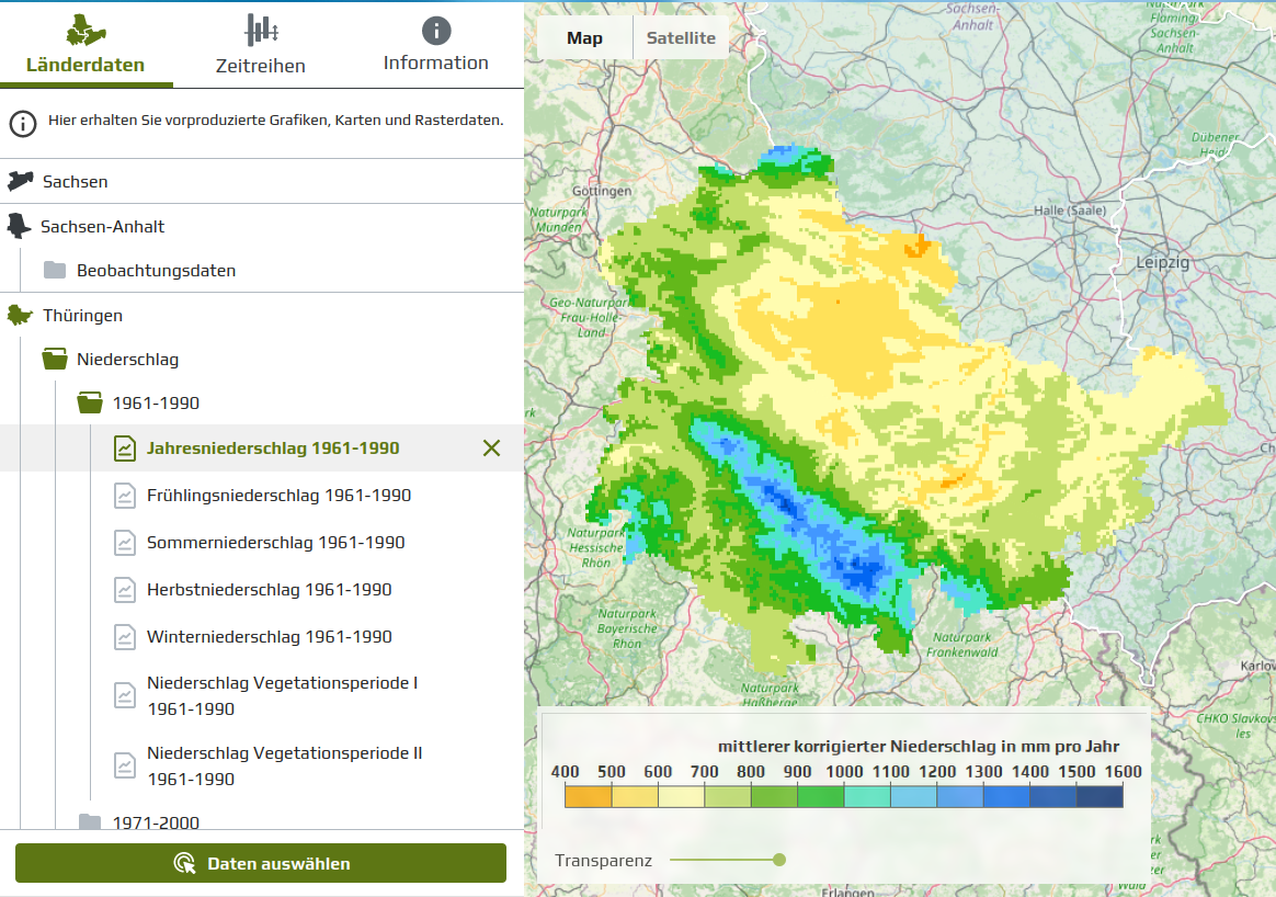
Be it maps, diagrams or dashboards, our designers will be happy to help you present the information obtained in the most user-friendly and descriptive way possible.Technology
For the development of geoinformation systems and geodatabases as well as for carrying out analyses, we use a variety of software tools that enable efficient data processing and high productivity.
ESRI ArcGIS Pro / Enterprise
QGIS Desktop / Server
Postgresql / PostGIS
MSSQL Server
GDAL / OGR
R
Python
Sample projects
Here are some examples where our expertise in GIS and spatial analytics helped developing IT tools or new datasets, which made the live of our customers much easier.